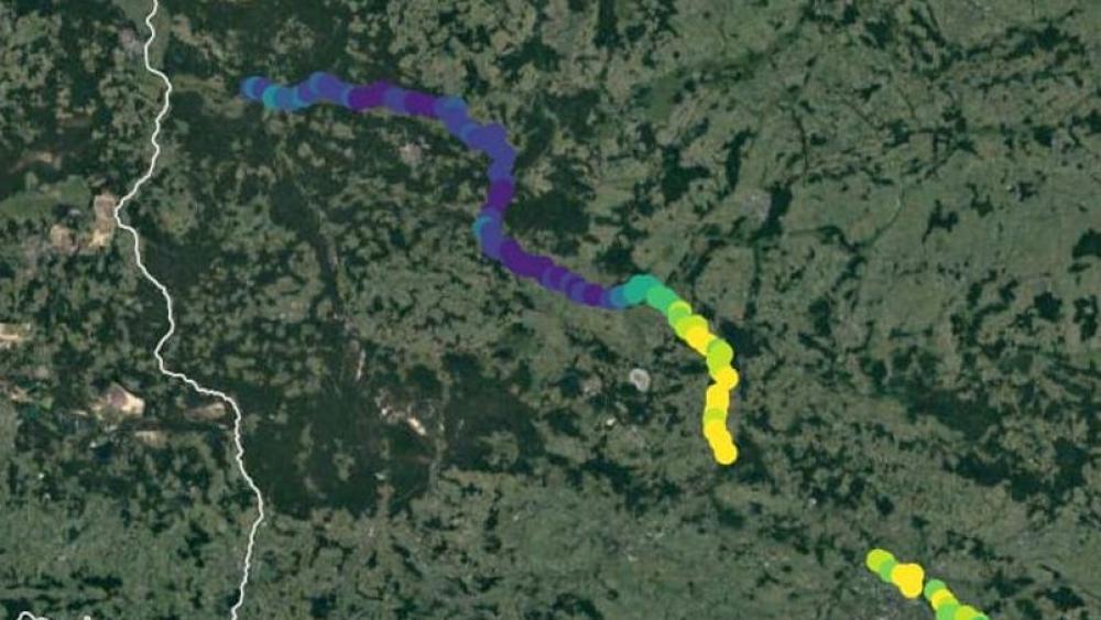
Satellite data from the summer of 2022 shows how the algal bloom has moved downstream in the Oder. © Brockmann Consult
How fast does an algal bloom grow and how does it spread in the river? Samples from individual measuring stations are only suitable to a limited extent for recording the spatio-temporal dynamics of mass blooms. Sensors from earth observation satellites such as the European Copernicus satellite Sentinel-2 fulfil this function better, as they also record colouring pigments such as algal chlorophyll over large areas and across borders within a water network.
Immediately after the disaster in the summer of 2022, scientists at the Leibniz Institute of Freshwater Ecology and Inland Fisheries (IGB) analysed satellite data from the River Oder with the support of a geoinformation company. This enabled them to understand how and where the algal bloom has grown and moved. In sub-project 4 "Data synthesis, monitoring and early warning system", current satellite data is being used as part of the ODER~SO project to obtain information on possible new developments of algal blooms in the upper reaches of the Oder and thus enable faster reactions in the lower reaches of the river.
To monitor chlorophyll concentrations, which serve as an indicator for algal blooms, Sentinel-2c MSI data is analysed virtually in real time. The remote sensing data will be merged with other data, including water chemistry and hydrological data from the field and laboratory. Processed four-dimensionally in the form of a so-called data cube, the data will be fed into a publicly accessible information platform. It will be used to identify critical threshold values for toxic algal blooms in the River Oder and as the basis for an early warning system based on cross-border monitoring data.

